
August 2026 Rasuwa-Tibet Disaster: Understanding the Anatomy of a Mega Flash-Flood
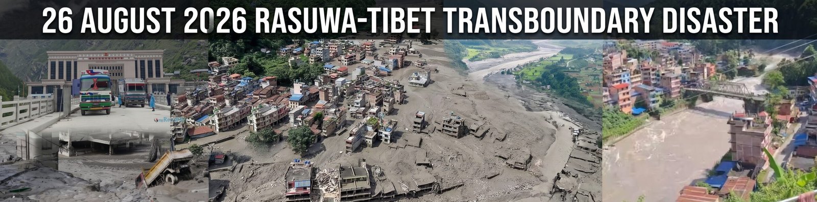
On the morning of August 26, 2026, a catastrophic flash flood and debris flow swept through the Tibet-Nepal border, devastating communities along a 72-kilometer stretch of the Trishuli River corridor.
1. The Trigger: A Geological Chain Reaction
Initial reports from government officials and early warning systems attributed the disaster to a tectonic earthquake, as global seismometers detected a magnitude 5.2 tremor in the region,.
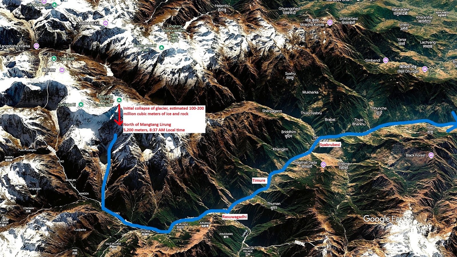
The Initial Collapse: At approximately 8:37 AM local time, an enormous section of an unnamed glacier, measuring roughly 610 meters in width, sheared off from an altitude of over 5,200 meters north of Langtang Lirung,.
The Physics of the Flow: The extreme kinetic energy, velocity, and friction from the impact instantly melted the falling ice,.
Velocity and Scale: Funneled into the Lhende Khola and Bhotekoshi river systems, this debris flow reached estimated speeds of up to 50 meters per second (180 km/h or 110 mph).
2. Devastation and Impact
The speed and volume of the debris flow gave border communities virtually no time to evacuate, resulting in mass casualties and the erasure of critical transboundary infrastructure.
Infrastructure and Economic Losses
-
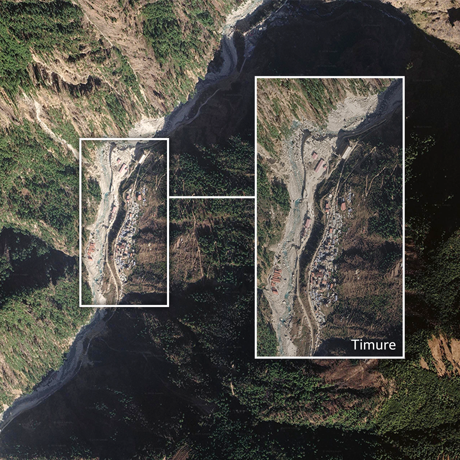
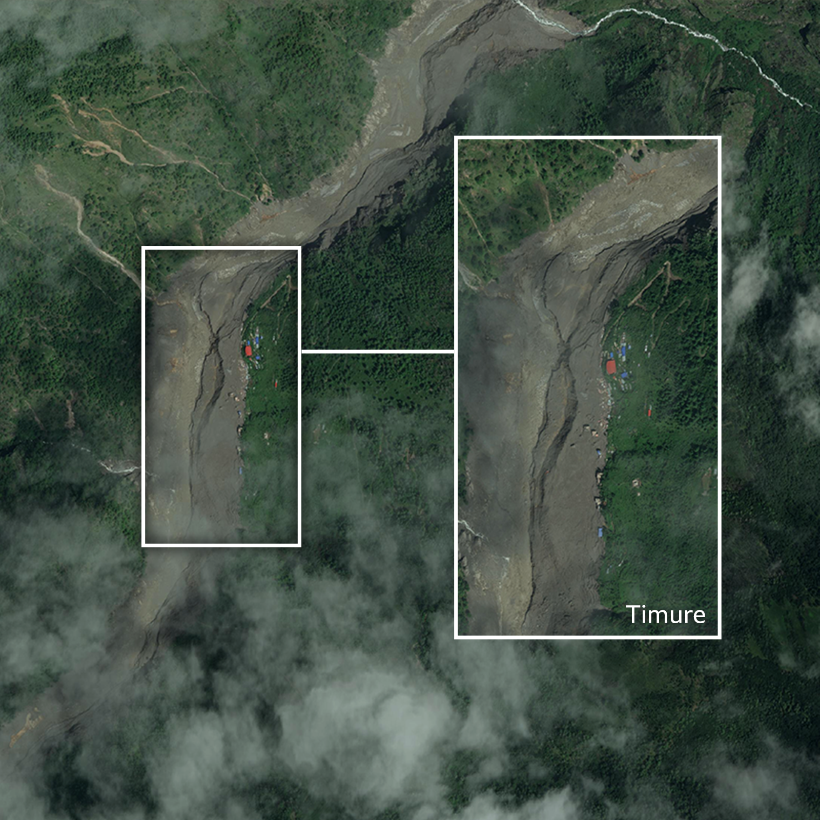
Border Crossing Erased: The Gyirong Port, which accounted for nearly 30% of bilateral trade between China and Nepal, was entirely swept away.
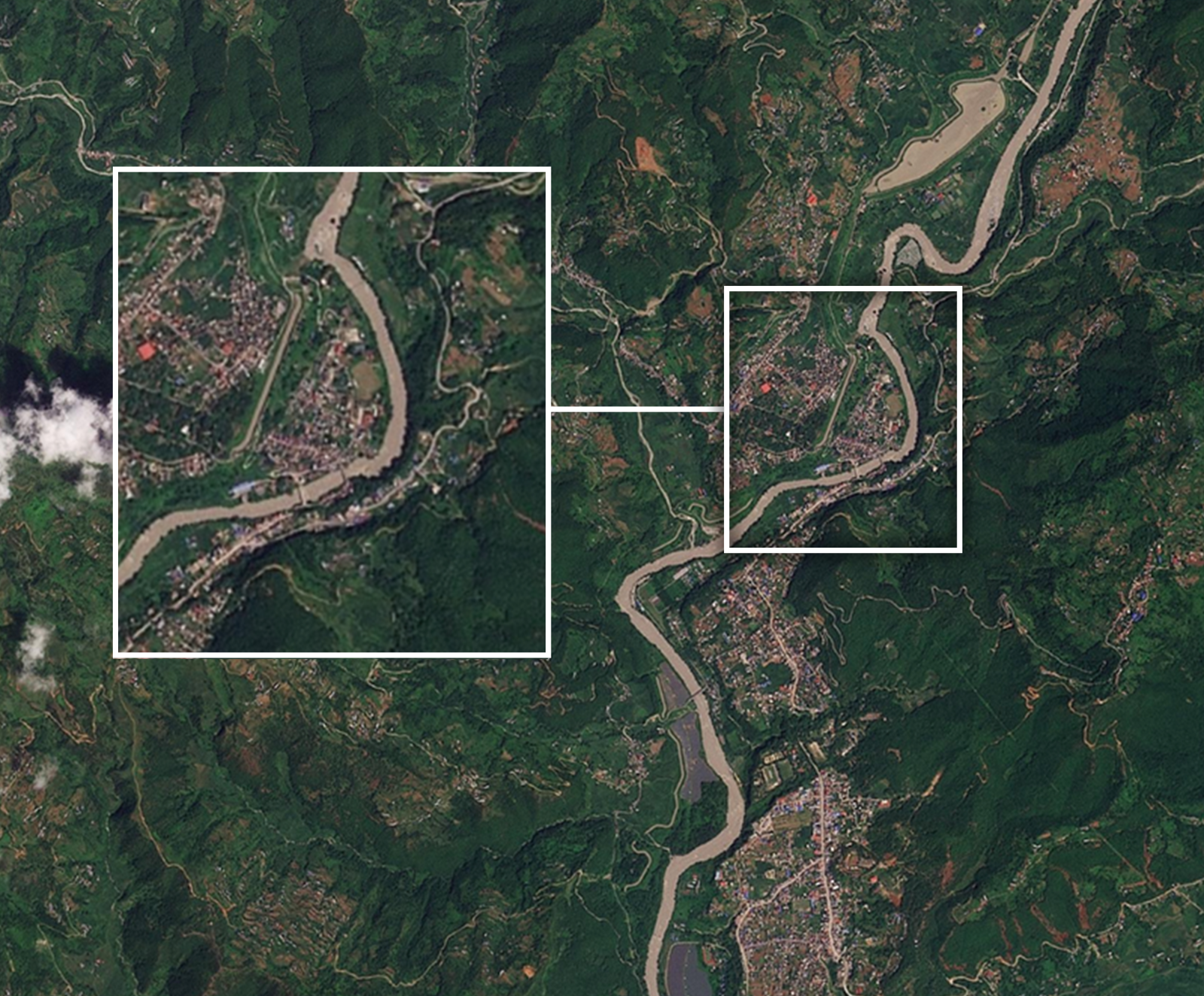
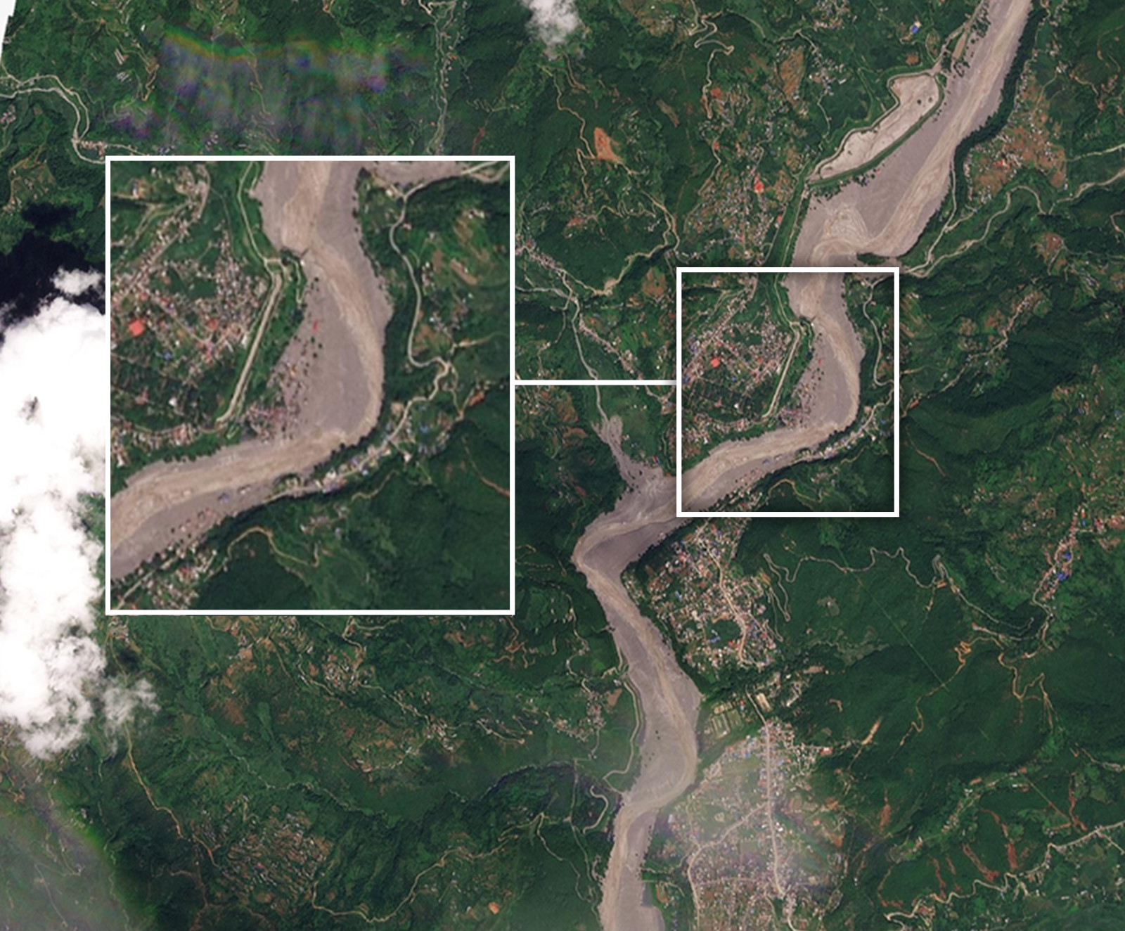
Surveillance footage from the Tibetan side captured multi-level parking structures collapsing as the wall of water overtook the facility in seconds. - Severed Lifelines: The flood destroyed over 41 bridges and washed away a 42-kilometer stretch of the main road linking Betrawati to the Rasuwagadhi border crossing, severely hindering rescue operations and trapping hundreds,
- Energy Grid Crippled: The disaster heavily damaged Nepal's energy sector. At least 15 operational and under-construction hydropower projects were hit, removing over 430 MW of power from the national grid,.
Heavily impacted facilities included the 111 MW Rasuwagadhi and 60 MW Upper Trishuli 3A projects.
Human Toll (as of 30 August, 2026)
-
Casualties: The National Disaster Risk Reduction and Management Authority (NDRRMA) reported at least 675 fatalities in Nepal, with Tibet reporting an additional 7 to 16 deaths,
- Missing Persons: Over 2,400 people were reported missing in Nepal alone, and the sheer force of the current carried the bodies of some victims up to 240 kilometers downstream into the Indian state of Uttar Pradesh,.
Hundreds of international tourists and Indian nationals were among the missing,
Nepal-Tibet border crossing (Rasuwagadhi) washed away
7 January 2026
28 August 2026
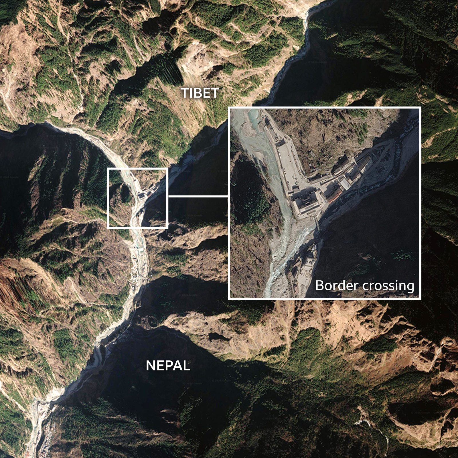
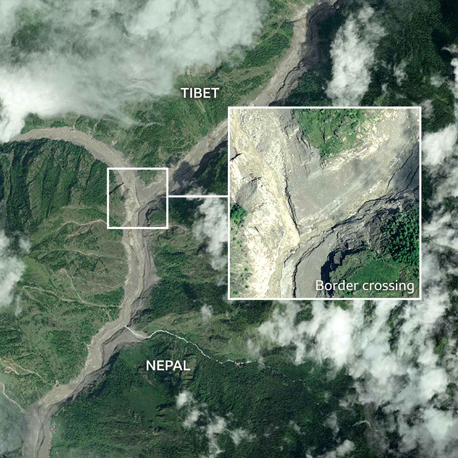
Source: Google, Vantor | BBC
Syabrubesi, Nepal
18 October, 2023
27 August 2026
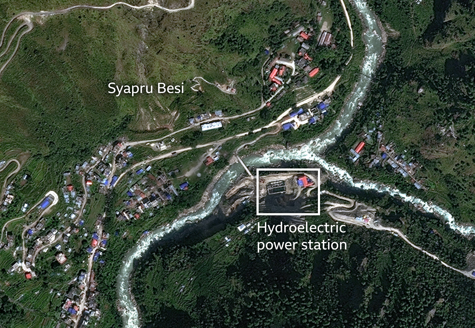
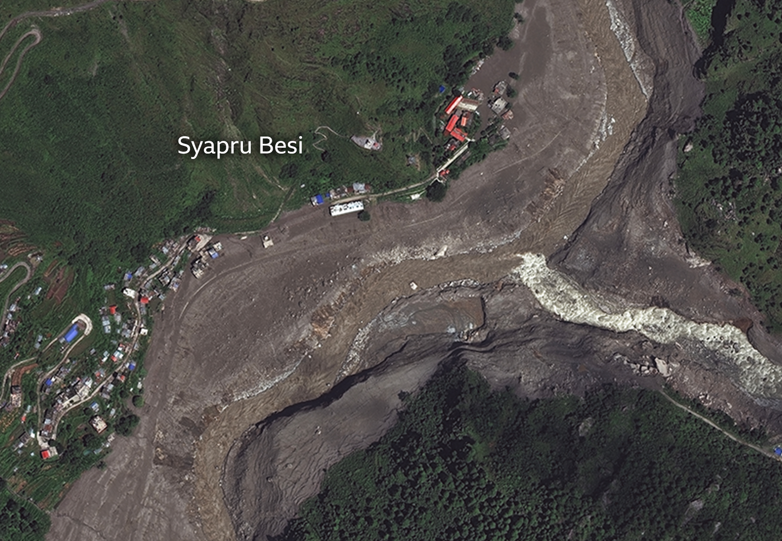
Source: Google, Vantor | BBC
Source: Google, Vantor | BBC
3. The Climate Reality and Future Implications
While investigators are still finalizing their assessments, scientists point to rapidly shifting climate dynamics in the Himalayas as a primary underlying vulnerability for these types of catastrophic failures.
-
Permafrost Degradation: The Himalayas are warming at a rate significantly higher than the global average. This warming is thawing high-altitude permafrost—the "glue" that stabilizes steep, rocky slopes beneath glaciers.
-
Comparisons to Past Disasters: Geomorphologists have compared the mechanics of the 2026 collapse to historical climate-induced geological disasters, noting that changing temperature gradients greatly increase the likelihood of massive bedrock failures.
-
Cascading Hazards: Following the initial event, satellite monitoring detected the formation of new, temporary lakes caused by landslide river blockages.
These blockages posed severe secondary flooding risks to downstream areas, forcing prolonged evacuations.
The August 2026 Rasuwa-Tibet flood is a stark demonstration of the destructive power of high-altitude geological failures. What was initially misidentified as an earthquake was, in reality, a massive cryospheric collapse, underscoring the urgent need to expand beyond traditional flood warnings. As the Himalayan landscape continues to respond to warming temperatures, safeguarding transboundary communities and infrastructure will require a shift toward advanced predictive monitoring of mountain slope stability and glacial integrity.