
Welcome to our Map collection!
Thematic map of Nepal – 1968
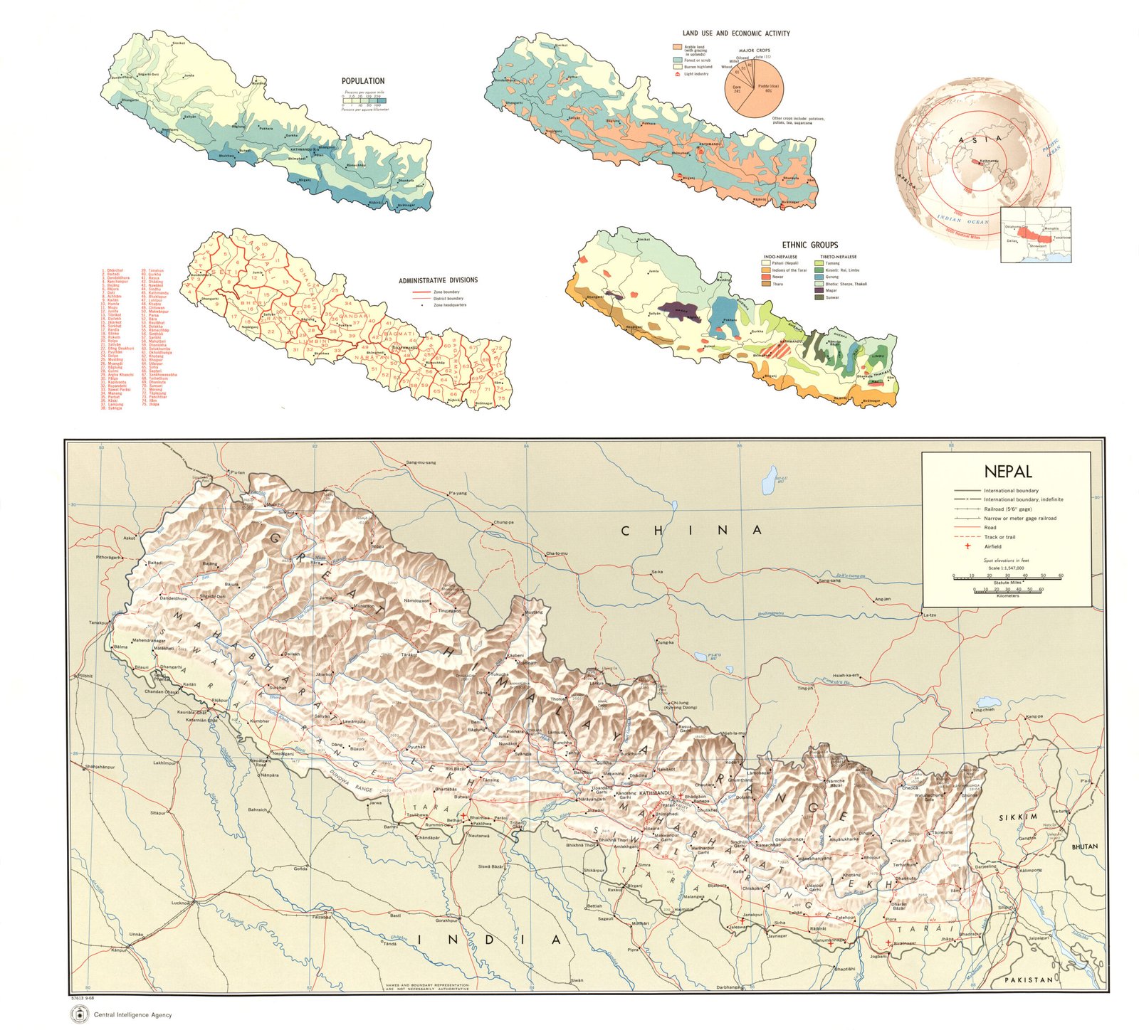
Title: Nepal (Population, Land Use and Economic Activity, Administrative Divisions, Location, Ethnic Groups, Shaded Relief)
Publisher / Developer: Central Intelligence Agency (CIA), Office of Basic and Geographic Intelligence
Publication Date: September 1968
Document / Map Control Number: Map No. 57613
Scale: Main map (Shaded Relief) 1:2,500,000; inset thematic maps vary
Classification: Public Domain / Unclassified US Government Work
Context:
Produced during the Cold War era in September 1968, this thematic map sheet served as a comprehensive geographic and strategic briefing reference for U.S. government officials.
Description:
The sheet features a prominent main map showing Nepal's physical terrain via shaded relief, elevation spot heights, major river networks, and transport routes (roads, tracks, trails, and airfields). Above the main map are four thematic inset maps paired with a regional global locator:
Population: Spatial density across the Terai, mid-hills, and high Himalayas.
Land Use and Economic Activity: Forested areas, arable land, grazing zones, and key economic centers (including an agricultural sector pie chart).
Administrative Divisions: Zonal and district boundaries with an indexed key.
Ethnic Groups: Spatial distribution of major ethnic communities across Nepal's geographic belts.