
Welcome to our Map collection!
Sketch of the Gorkha Possessions from Dakabag West to the Valley of Nepal
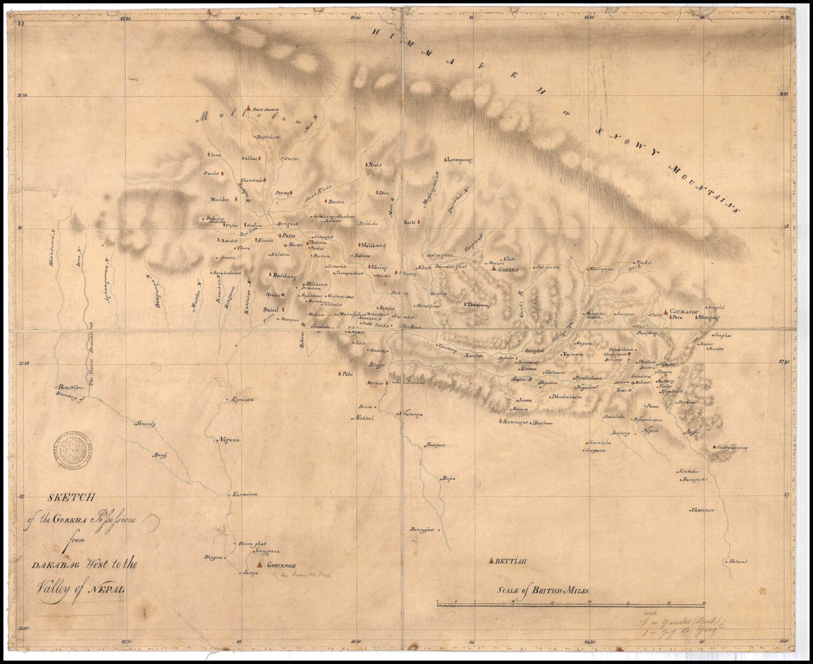
Title: Sketch of the Gorkha Possessions from Dakabag West to the Valley of Nepal (cataloged as 1830s Sketch of the Gorkha Possessions)
Publisher / Developer: British East India Company (Residency Cartographic Intelligence / Brian Houghton Hodgson)
Publication Date: Circa 1830s
Archive Reference: Held in the British Library / British East India Company Cartographic Collection; digitized on pahar.in
Scale: Scale of British Miles (approx. 9 British miles to 1 inch / 7.7 Geog. miles to 1 inch)
Classification: Historical Manuscript Sketch Map (Public Domain)
Context:
Compiled during the 1830s while Brian Houghton Hodgson served as the British Resident in Kathmandu, this manuscript sketch drew on native route intelligence, local guides, and previous East India Company surveys to track strategic corridors along Nepal's southern borderlands.
Description:
Drawn across a coordinate grid with soft brush shading for mountain ranges, the map illustrates central and western Nepal from Bettiah and Gorakhpur in the south up to the "Himmaleh or Snowy Mountains" in the north. It traces river systems (Gandaki, Rapti, Bagmati) and key regional centers—including "Catmandoo", "Gorkha", "Palpa", and "Butwel"—to document military routes, mountain passes, and border towns between British India and Nepal.