
Welcome to our Map collection!
Route Surveyed by the Pundit Explorers in Great Tibet, Upper Brahmaputra, in Nepal, and in the Himalayas
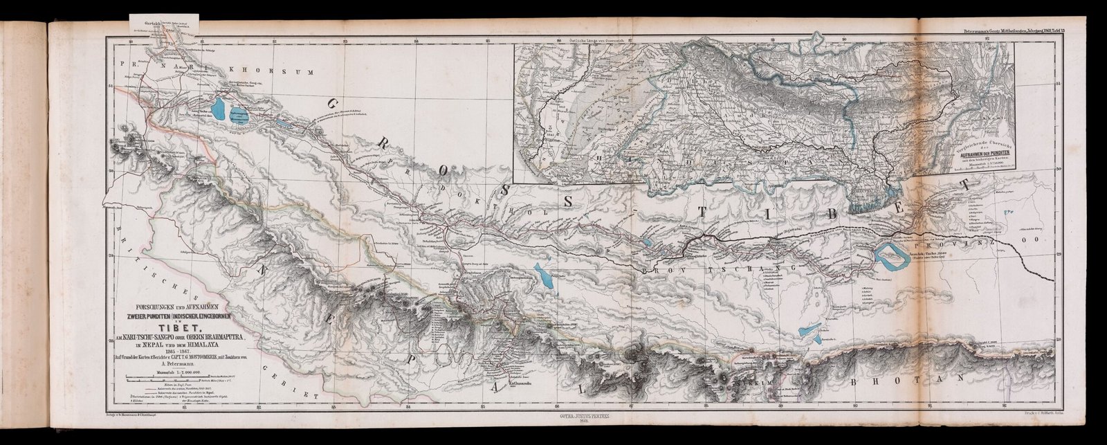
Title: Map showing the Route Surveyed by the Pundit Explorers in Great Tibet, along the Nari-Chu-Sangpo or Upper Brahmaputra, in Nepal, and in the Himalayas, 1865–1867
Cartographer / Supervisor: Lt.-Col. Thomas George Montgomerie (Great Trigonometrical Survey of India)
Explorers / Primary Data Sources: Nain Singh Rawat (Pundit "A-K" / "The Pundit") and Mani Singh Rawat (Pundit "G-M-N")
Publisher: Published for the Royal Geographical Society by John Murray, London
Publication Date: 1868 (published in the Journal of the Royal Geographical Society, Vol. 38, 1868)
Engraver / Lithographer: Edward Weller (Lithographer, Duke Street, Bloomsbury, London)
Scale: Scale of English Miles (approx. 1 inch = 33 miles)
Classification: Historical Secret Exploration / Route Survey Map (Public Domain)
Directed by T.G. Montgomerie, this landmark cartographic document records the famous first long-range clandestine expedition (1865–1867) of the "Pandits"—native Himalayan cartographers trained by the British to survey regions strictly closed to foreigners. Chief among them was Nain Singh Rawat, who walked over 1,200 miles from Kathmandu to Lhasa and along the Yarlung Tsangpo, measuring distance using a 100-bead buddhist rosary tuned to a 2,000-pace standard.
Route Traverses: Traces the covert travel routes in red across northern Nepal, western Tibet (Nari), central Tibet (U-Tsang), and up to Lhasa.
Hydrography & Topography: Maps the course of the Upper Brahmaputra (Nari-Chu-Sangpo), alpine lakes (Manasarovar, Rakshastal, Yamdrok Lake), mountain passes, and elevation spot heights recorded via boiling-point thermometers.
Top Inset Map: Features an upper-right inset showing the regional connectivity of the trans-Himalayan drainage network to the wider Indian subcontinent.