
Welcome to our Map collection!
Political map of Nepal – 2007
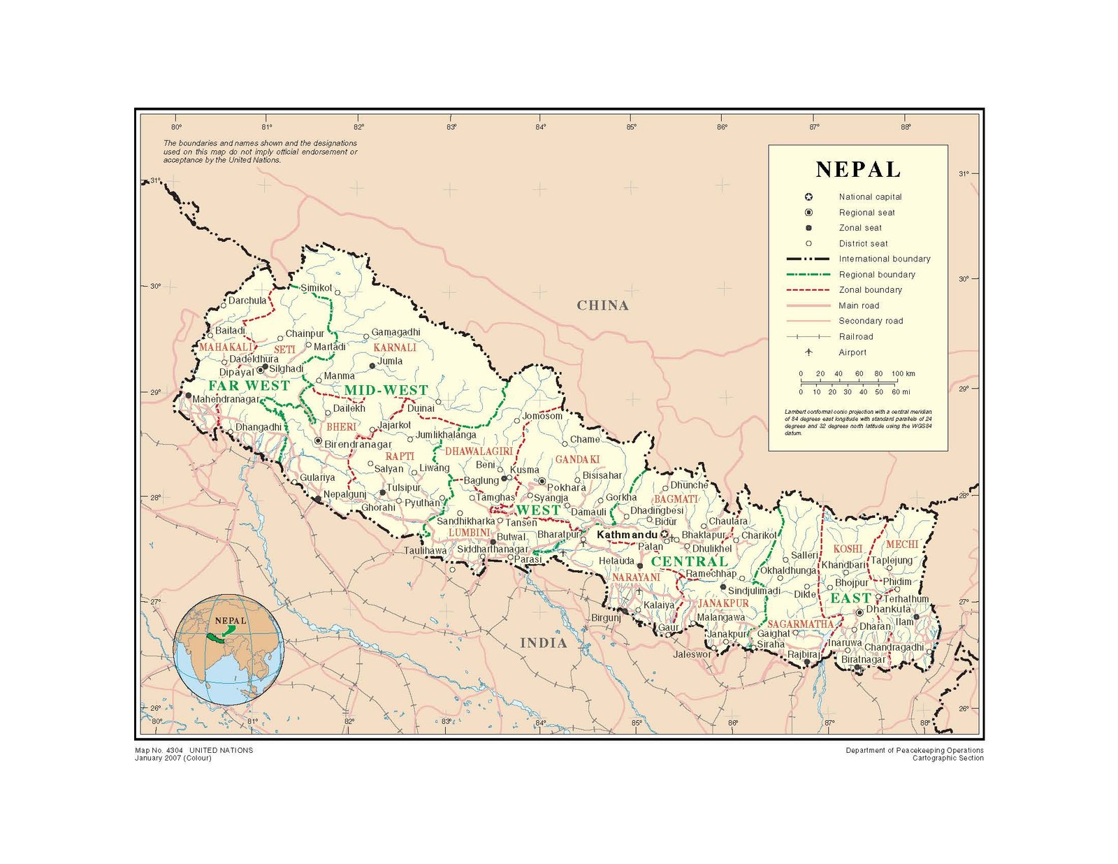
Title: NEPAL (Map No. 4304)
Publisher / Developer: United Nations Department of Peacekeeping Operations, Cartographic Section
Publication Date: January 2007 (Colour)
Document Number: Map No. 4304 UNITED NATIONS
Projection: Lambert Conformal Conic Projection (Central Meridian 84°E, Standard Parallels 24°N and 32°N, WGS84 Datum)
Classification: Official United Nations Map / Public Domain (UN Information Product)
Context:
Published in early 2007, this map was created by the UN DPKO Cartographic Section to support United Nations field operations, peace building, and humanitarian missions in Nepal (including the United Nations Mission in Nepal, UNMIN) following the 2006 Comprehensive Peace Agreement.
Description: The map illustrates Nepal's political and administrative framework prior to the 2015 federal constitution. It details:
- 5 Development Regions (Far-West, Mid-West, West, Central, and East) outlined in green.
- 14 Administrative Zones (Mahakali, Seti, Karnali, Bheri, Rapti, Dhawalagiri, Gandaki, Lumbini, Bagmati, Narayani, Janakpur, Koshi, Mechi, and Sagarmatha) outlined in red.
- Administrative capitals, district seats, primary/secondary road networks, airports, and railways across the country.
- An inset global globe showing Nepal's location in South Asia.