
Welcome to our Map collection!
Political Map of Nepal – 1990
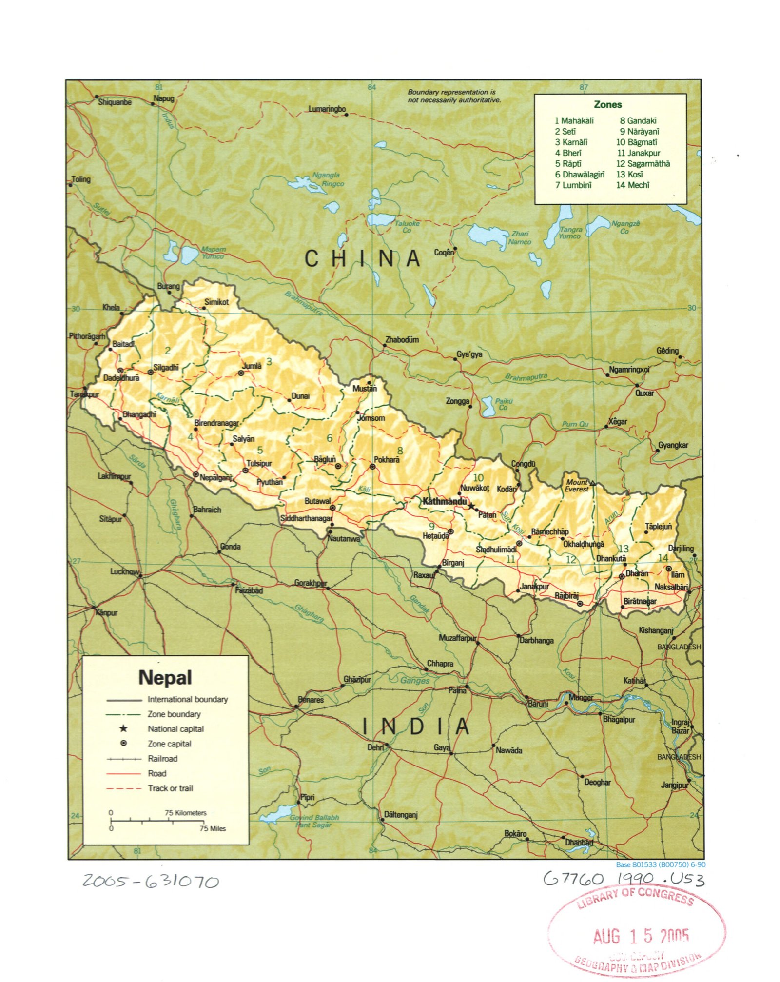
Title: Nepal (Political)
Publisher / Developer: Central Intelligence Agency (CIA), Directorate of Intelligence
Original Map Base Date: June 1990 (indicated by Base 801533 (B00750) 6-90 at the bottom right)
Library of Congress Processing Date: August 15, 2005 (indicated by the Library of Congress Geography & Map Division deposit stamp)
Library of Congress Call Number / Control Number: G7760 1990 .U53 / 2005-631070
Scale: 1:4,500,000 (approximate, based on the 75 km / 75 miles scale bar)
Classification: Public Domain / Unclassified US Government Document
Context:
This is the standard 1990 CIA political reference map of Nepal cataloged and stamped into the permanent collection of the Library of Congress Geography and Map Division on August 15, 2005.
Description:
As a political map, it focuses on administrative divisions and infrastructure rather than physical terrain. It delineates Nepal's 14 administrative Zones (Anchal) indexed 1 through 14 (Mahākālī to Mechī) and highlights national and zonal capitals, road networks, rail lines, tracks/trails, and international boundaries with neighboring regions in India, China (Tibet), and Bangladesh.