
Welcome to our Map collection!
Nepaul (Nepal)
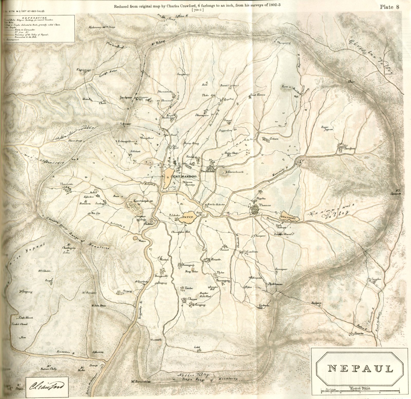
Title: Nepaul (Plate 8: Reduced from original map by Charles Crawford, 6 furlongs to an inch, from his surveys of 1802–3)
Author / Cartographer: Charles Crawford (Lieutenant / Captain in the East India Company's Service)
Survey Date: 1802–1803 (during Captain William Knox's diplomatic residency mission to Kathmandu)
Archive Reference: Cataloged as Plate 8, British Library / India Office Records collection (and available via pahar.in)
Scale: Reduced to 6 Furlongs to an Inch (scale bar in British Miles and Furlongs at the bottom right)
Classification: Historical Survey / Manuscript Map (Public Domain)
Context:
Charles Crawford accompanied Captain William Knox’s official diplomatic mission to Nepal in 1802–1803. While in the valley, Crawford conducted the first systematic astronomical, trigonometric, and topographical survey of the Kathmandu Valley basin by a European cartographer.
Description:
The map offers a remarkably precise early 19th-century view of the Kathmandu Valley:
Urban Centers: Depicts Catmandoo, Patun, and Bhatgong (Bhaktapur).
Topography: Features the surrounding mountain rim, including Chandra guery Range of Mountains (Chandragiri), Mt. Shivapuri, and Mt. Phulchoak.
Hydrology & Landmarks: Traces the Bagmati and Vishnumati rivers along with key cultural landmarks such as Boodhnauth, Pashupatinath, and Swayambhunath.
Legend: Includes a top-left reference key defining symbols for religious buildings, roads to Kathmandu, valley boundaries, and mountain passes.