
Welcome to our Map collection!
Nepal shaded relief map – 1990
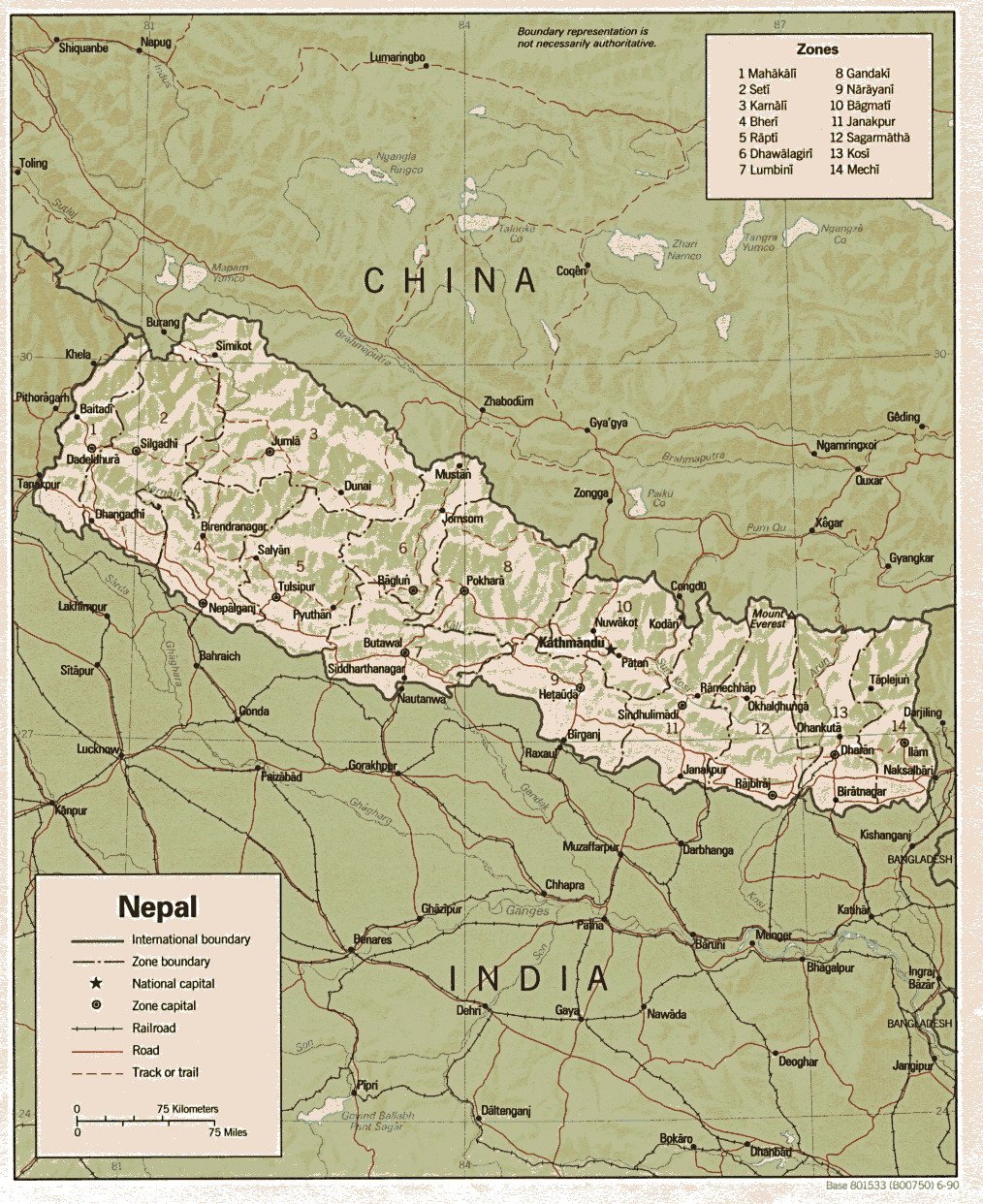
Title: Nepal (Shaded Relief)
Publisher / Developer: Central Intelligence Agency (CIA), Directorate of Intelligence
Publication Date: June 1990 (indicated by 6-90 in the bottom-right corner)
Document Control Number: Base 801533 (B00750) 6-90
Scale: 1:4,500,000 (approximate, based on the 75 km / 75 miles scale bar)
Classification: Public Domain / Unclassified US Government Work
Context:
Produced in 1990 by the CIA's cartographic division, this map served as a standard reference overview for administrative divisions, major transport networks, and physical terrain in Nepal during the transition era of the constitutional monarchy.
Description:
The map utilizes shaded relief to illustrate Nepal's rugged elevation profile, from the Terai plains to the High Himalayas. It explicitly indexes the 14 administrative Zones (Anchal)—from Mahākālī (1) to Mechī (14)—and highlights zone capitals, national transport corridors (roads, tracks, and rail links), and surrounding territories across India, China (Tibet), and Bangladesh.