
Welcome to our Map collection!
Nepal – China boundary map
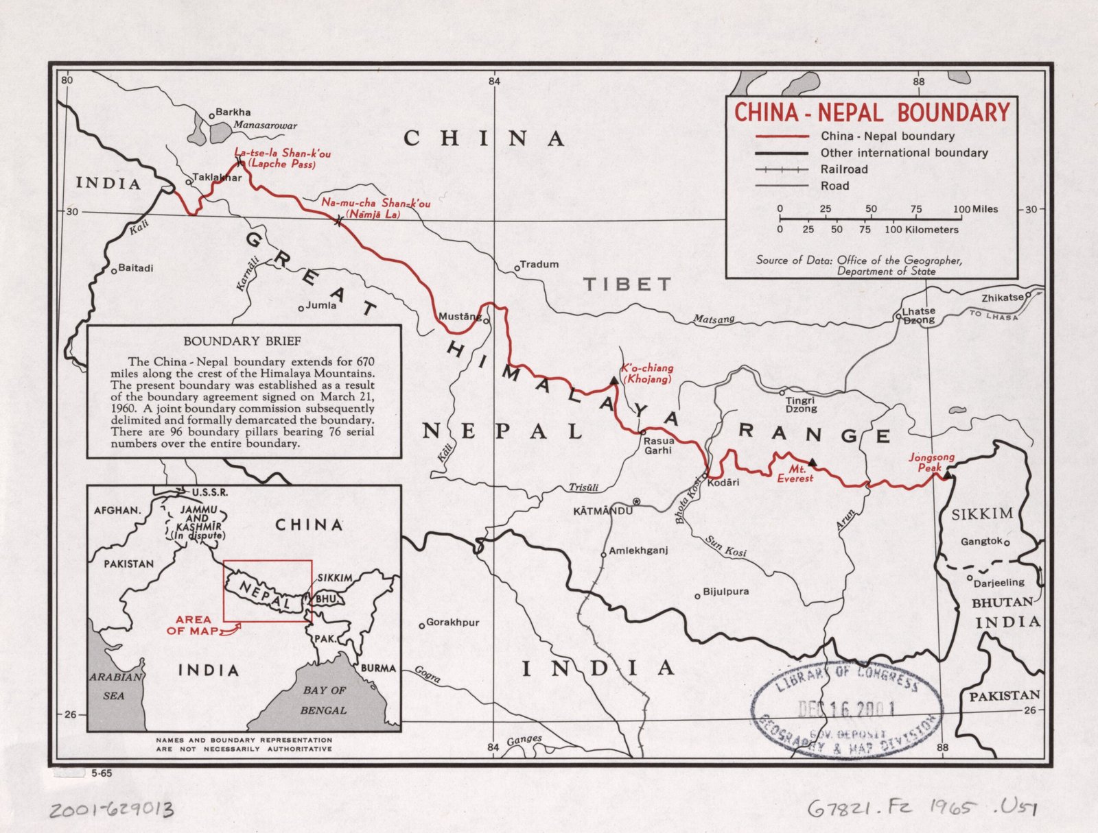
Title: China – Nepal Boundary (International Boundary Study / Boundary Brief)
Publisher / Developer: Office of the Geographer, Department of State (USA)
Original Publication Date: May 1965 (indicated by 5-65 at the bottom left; Library of Congress deposit stamp dated DEC 16 2001)
Library of Congress Call Number: G7821.F2 1965 .U51 / 2001-629013
Scale: Bar scale showing 0–100 Miles / 0–100 Kilometers
Classification: Public Domain / Unclassified US Government Document
Context:
Published as part of the U.S. Department of State's official International Boundary Study series, this thematic map documents the international border alignment finalized under the March 21, 1960 Boundary Agreement between Nepal and the People's Republic of China, followed by formal Joint Boundary Commission demarcation.
Description:
Tracing a total of 670 miles along the crest of the Great Himalaya Range, the red line highlights key strategic passes and border markers—including La-tse-la Shan-k'ou (Lapche Pass), Na-mu-cha Shan-k'ou (Namja La), K'o-chiang (Khojang), Rasua Garhi, Kodāri, Mt. Everest, and Jongsong Peak (the eastern tri-junction with Sikkim). An inset box (Boundary Brief) summarizes treaty negotiations and notes the placement of 96 boundary pillars with 76 serial numbers.