
Welcome to our Map collection!
Nepal and Northern India
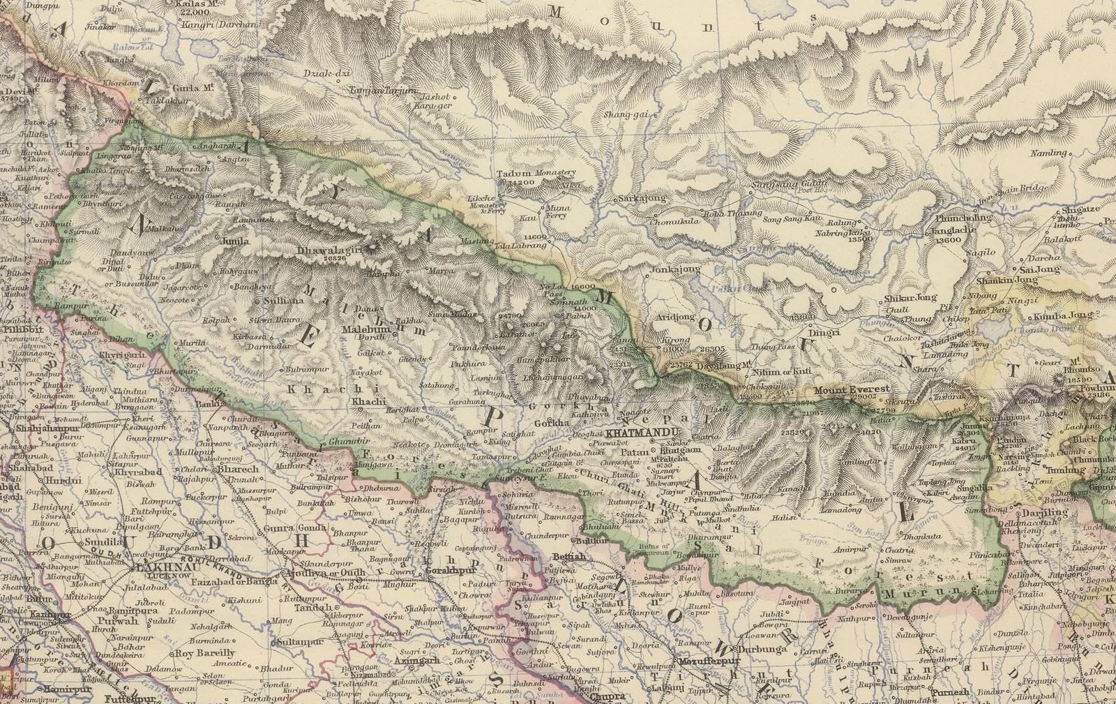
Title: India (North-Eastern Sheet) / Nepal and Northern India
Cartographer / Publisher: Keith Johnston, F.R.S.E. / Published by W. & A. K. Johnston (Edinburgh & London)
Publication Date: Circa 1861–1877 (featured in various editions of Keith Johnston's The Royal Atlas of Modern Geography)
Engraver: W. & A.K. Johnston
Scale: Approx. 1:3,500,000
Classification: Historical Steel-Engraved Map (Public Domain)
Produced by the renowned Scottish cartographic firm W. & A. K. Johnston for The Royal Atlas, this map captures the mid-to-late 19th-century geographical understanding of the Central and Eastern Himalayas. It reflects cartographic data published following the Great Trigonometrical Survey of India announcements in the 1850s.
Territorial Outlines: Highlights N E P A U L outlined in hand-colored green, bounded by Tibet (MOUNT) to the north, British India (Oude, North-West Provinces, Tirhoot, Purneah) to the south, and Sikkim/Darjeeling to the east.
Topography & Mountains: Employs fine steel engraving hachures to depict the Himalayan massifs, explicitly naming major peaks such as Dhawalagiri (26,826 ft), Dayabung (23,762 ft), and Mount Everest (29,002 ft).
Regional & Historic Divisions: Labels historical regions and former principalities within Nepal, including Jumla, Malebum, Sulliana, Khachi, Gorkha, Kathmandie, Patan, Bhatgong, and Morang.