
Welcome to our Map collection!
Natural Divisions of the Himalayas
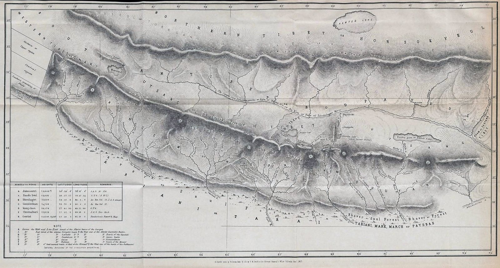
Title: Natural Divisions of the Himalayas (or Physical Map of the Himalayas)
Author / Cartographer: Brian Houghton Hodgson (1800–1894)
Publisher / Developer: Surveyor General's Office, Calcutta (lithographed by T. Black & Co.)
Publication Date: April 1857 (published in the Journal of the Asiatic Society of Bengal, Vol. 26, 1857)
Scale: Non-standard physical overview scale
Classification: Historical Physical & Hydrographic Map (Public Domain)
Designed by Brian Hodgson—the former British Resident in Nepal and a pioneering Himalayan naturalist—this map was created to illustrate his physical and hydrographic theory of the Himalayan range. Hodgson argued that the Himalayas are naturally divided into distinct physical sections defined by major river systems rather than arbitrary political boundaries.
Description:
Himalayan Physical Divisions: Features continuous shading of the main Himalayan ranges (Western, Central, and Eastern Himalayas), tracing the main trans-Himalayan drainage zones and plateau regions (Nari / Gnari, Utsang, Bbod / Tibet, and Sikim / Bhutan).
River Basins: Maps the four primary river systems breaking through the range—the Ganges, Karnali (Sardah), Gandaki, and Kosi networks.
Table & Notes (Bottom-Left): Contains a table listing key Himalayan peaks (Jamnoutri, Nanda Devi, Dhoulagiri, Gosainthan, Kangchan, Chumalhari, and Gemini) along with calculated heights, latitudes, longitudes, and survey publication remarks.
Southern Belt: Outlines the lowland foothill zones labeled Bhaver or Saul Forest and Tariani, Mari, March or Paysbas (the Terai).