
Welcome to our Map collection!
Map of the Dominions of the House of Gorkha
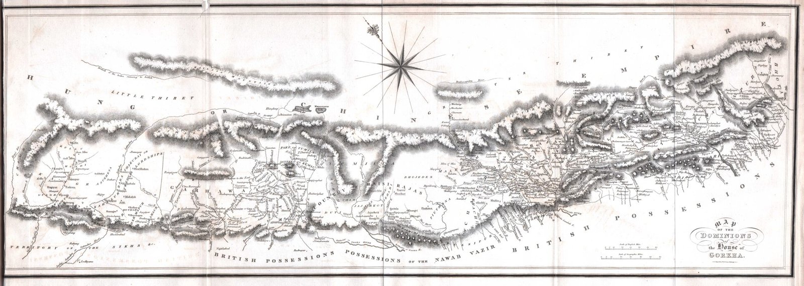
Title: Map of the Dominions of the House of Gorkha
Author / Cartographer: Francis Buchanan-Hamilton (M.D., F.R.S.)
Publisher / Developer: Published by Archibald Constable and Company, Edinburgh (and Longman, Hurst, Rees, Orme, and Brown, London)
Publication Date: 1819 (featured in his landmark volume, An Account of the Kingdom of Nepal and of the Territories Annexed to this Dominion by the House of Gorkha)
Engraver: J. & G. Menzies (Edinburgh)
Scale: Scale of British Miles (approx. 1 inch = 30 miles)
Classification: Historical Cartographic Manuscript / Rare Book Plate (Public Domain)
Context:
Compiled following Francis Buchanan-Hamilton's mission to Kathmandu in 1802–1803 and extensive research along the northern frontier of Bengal and Oudh, this map represents one of the earliest comprehensive Western cartographic depictions of the Gorkha Empire at its territorial height before the Treaty of Sugauli (1816).
Description:
Printed in a wide landscape format, the map illustrates the vast expanse of the Gorkha realm spanning from the Teesta River in the east across the central Himalayas to the Sutlej River and Kumaon/Garhwal in the west. It details:
The Himalayan mountain barriers bordering the Chinese Empire and Tibet to the north.
The southern boundary adjoining British Possessions and the Possessions of the Nawab Vazir of Oudh.
Internal river basins (Kosi, Gandaki, Karnali, Mahakali), hill principalities (Baise and Chaubisi rajyas), and trade passes across the region.