
Welcome to our Map collection!
Map of Nepaul (Nepal), with the Routes &c. of Capt. Kirkpatrick
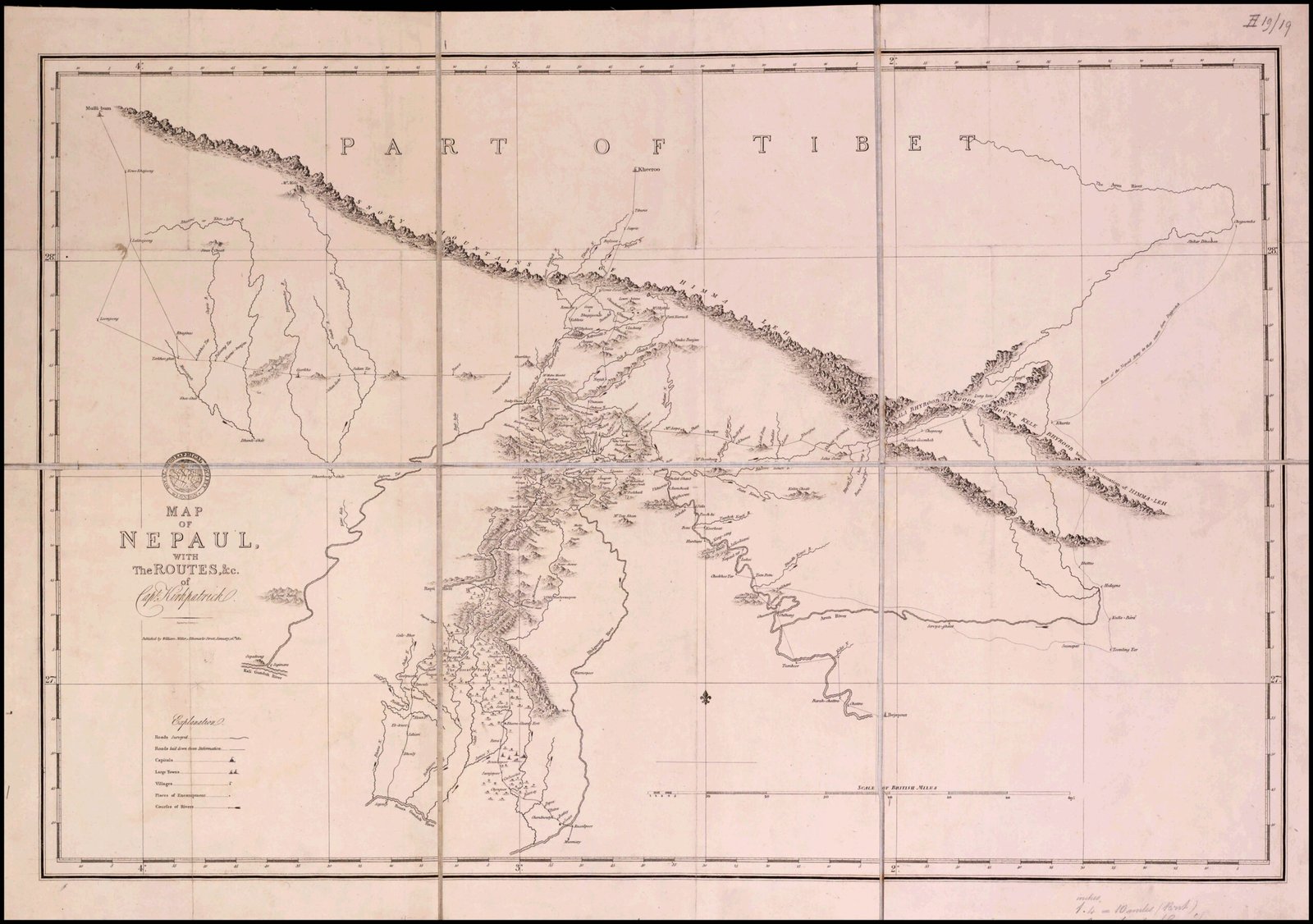
Title: Map of Nepaul, with the Routes &c. of Capt. Kirkpatrick
Publisher / Developer: Drawn by Colonel William Kirkpatrick; engraved and published by Aaron Arrowsmith (Hydrographer to the Prince Regent / King)
Publication Date: 1811 (reissued/referenced in 1821 collections; originally published in Kirkpatrick’s An Account of the Kingdom of Nepaul, London, 1811)
Scale: Approx. 10 British miles to 1 inch
Classification: Historical Topographical Map (Public Domain)
Context:
Colonel William Kirkpatrick led the first official British diplomatic mission to Kathmandu in 1793 during the Sino-Nepalese War. This map documents his expedition's traverse routes, representing one of the earliest Western mapping efforts of central Nepal's interior and Himalayan passes.
Description:
Drawn on a latitude-longitude grid with fine hachuring for mountain terrain, the map illustrates Kirkpatrick's travel routes from the Gangetic plains through the Terai and mid-hills up to the Kathmandu Valley. It marks river networks, mountain ridges, regional boundaries, key villages, and encampments, while outlining adjacent areas of Tibet to the north.