
Welcome to our Map collection!
Map of Nepal (Political and Administrative)- English
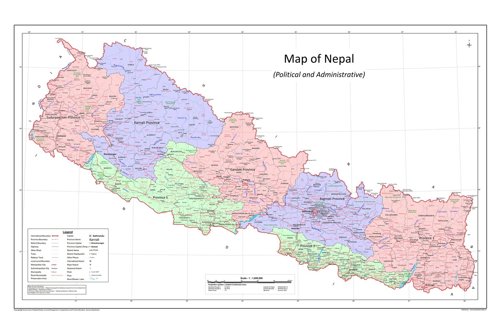
Title: Map of Nepal (Political and Administrative)
Publisher / Developer: Survey Department, Government of Nepal
Publication Date: May 2020 (Jestha 2077 B.S.) — Official English release of the updated national map (Chuche Naksha)
Scale: 1:1,000,000 (indicated by the Scale 1:1,000,000 text above the bar scale)
Language: English
Classification: Official Government / National Political & Administrative Map (Public Record)
This map is the official English-language edition of the revised national political and administrative map released by the Government of Nepal in May 2020 (Jestha 2077 B.S.). Produced by the Survey Department (Nepal's national mapping agency), it incorporates the updated northwestern international border line in Darchula District (Sudurpashchim Province) along with the post-2015 constitution federal structure.
Federal Structure: Displays Nepal's 7 Federal Provinces (Province 1, Province 2, Bagmati Province, Gandaki Province, Lumbini Province, Karnali Province, and Sudurpaschim Province) in distinct pastel colors.
Administrative Divisions: Delineates all 77 district boundaries, local levels (Municipalities and Rural Municipalities), and major urban centers using English nomenclature.
Transport Infrastructure: Features major highway networks, secondary roads, seasonal tracks, and airport locations across all provinces.
Legend (Bottom-Left): Outlines map symbology for international, provincial, district, and local unit boundaries, provincial capitals (Kathmandu, Birendranagar, etc.), district seats, peaks, and road networks.