
Welcome to our Map collection!
ASIE. TERRITOIRE DU NEPAUL (Asia. Territory of Nepal)
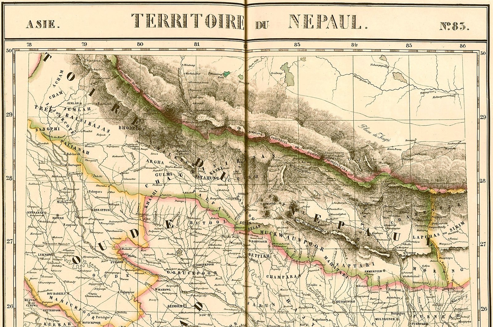
Title: ASIE. TERRITOIRE DU NEPAUL. No. 85
Author / Cartographer: Philippe Vandermaelen (1795–1869)
Atlas Title: Atlas Universel de Géographie Physique, Politique, Statistique et Minéralogique (Volume 2: Asie)
Publication Date: 1827 (Brussels)
Scale: 1:1,641,836 (Uniform scale used across the entire atlas sheet series)
Projection: Modified Conic Projection (First world atlas constructed using a uniform projection and scale)
Classification: Historical Regional Map / Lithographic Atlas Plate (Public Domain)
Produced in Brussels in 1827 for Philippe Vandermaelen's groundbreaking Atlas Universel, Sheet No. 85 is notable in cartographic history as part of the first atlas published using lithography where every map was drawn on a uniform scale. Vandermaelen compiled data from British East India Company surveys (including Francis Buchanan-Hamilton and Charles Crawford) to map the Himalayan frontier shortly after the Treaty of Sugauli (1816).
Regional Coverage: Spans from 78° to 86° East Longitude and 26° to 30° North Latitude, encompassing Nepal, parts of Oudh (Oude), Gorakhpur, Bihar, Sikkim, and southern Tibet (Plaine de Tingri).
Historical Political Divisions: Details traditional regional principalities and regions in French nomenclature:
Baise & Chaubisi Rajyas: Trikos de Baisrajhas (Baise Rajyas), Jemlah (Jumla), Sallianah (Salyan), Gulmi, Argha, Kaski, and Gorkah (Gorkha).
Central & Eastern Regions: Nepaul (Kathmandu Valley), Muckwaunpoor (Makwanpur), Saptari, Morang, and Lapchas ou Sikim (Lepchas/Sikkim).
Terrain & Boundaries: Uses hand-colored outline borders and hachuring to depict the High Himalayas (Monts Himalaya Couvertes de Neiges Perpétuelles), river drainage networks (Karnali, Gandaki, Kosi), and the southern lowland Terai border with British India.