
Welcome to our Map collection!
INDIA AND ADJACENT COUNTRIES: Kathmandu(Sheet No. 72)
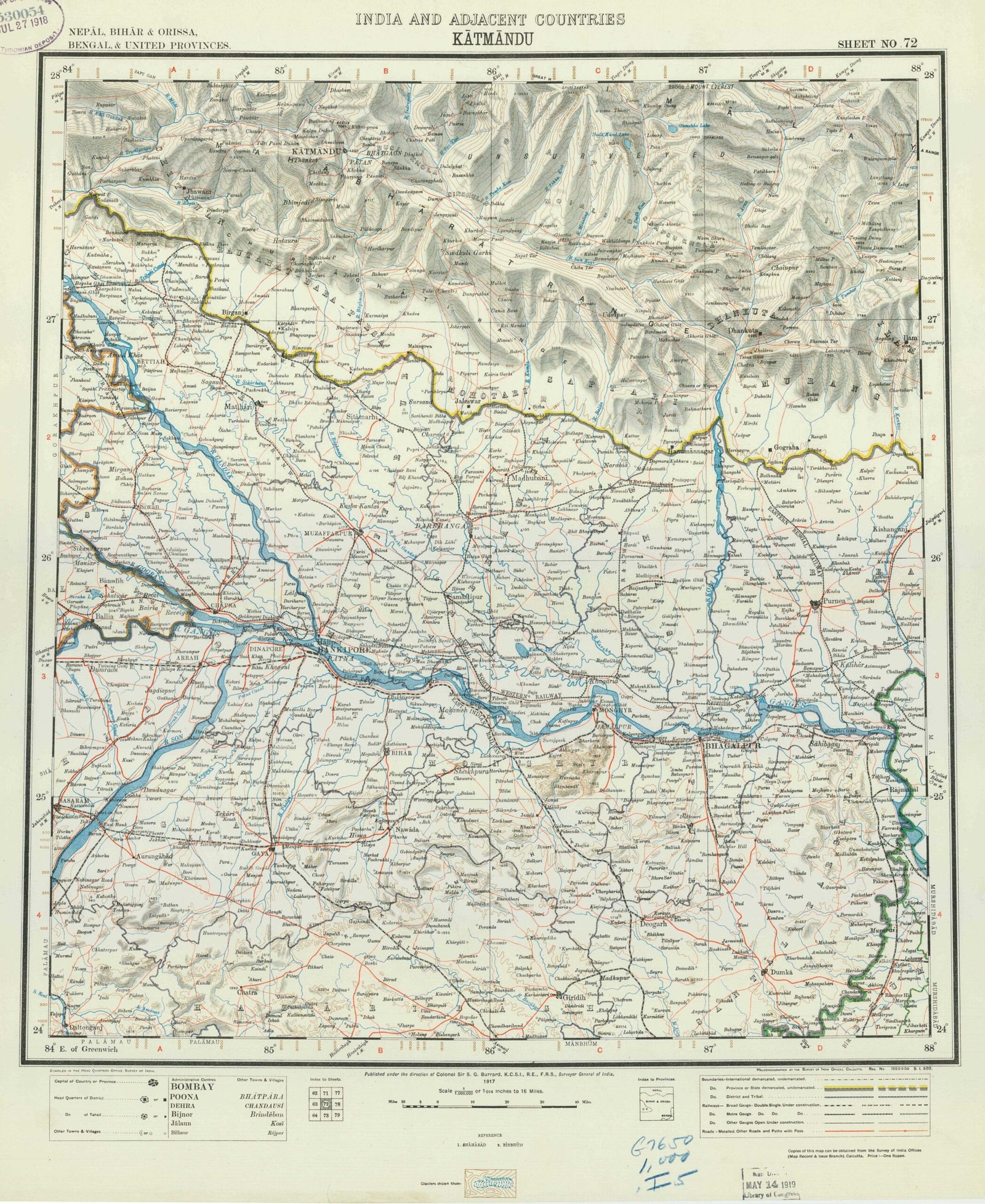
Title: INDIA AND ADJACENT COUNTRIES: Kathmandu(Sheet No. 72)
Publisher / Developer: Survey of India Offices, Calcutta (under the Direction of Colonel S.G. Burrard)
Publication Date: 1917 (indicated under the scale bar; deposit stamps show JUL 27 1918 and Library of Congress entry MAY 24 1919)
Library of Congress Call Number: G7650 1,000 .I5 / Control No. 530054
Scale: 1:1,000,000 (1 Inch to 15.78 Miles / 1 Millionth Scale Series)
Coverage Area: 24° to 28° North Latitude, 84° to 88° East Longitude (Nepāl, Bihār & Orissa, Bengal & United Provinces)
Classification: Topographical Survey Map / Public Domain (Historical Reference)
Published in 1917 during World War I, this map forms part of the Survey of India's famous 1:1,000,000 "India and Adjacent Countries" cartographic series. Compiled using triangulations, route surveys, and boundary commissions of the late 19th and early 20th centuries, it provided the British Indian administration with a standardized regional framework spanning central Nepal, northern Bihar, and Bengal.
Regional & Topographical Coverage: Encompasses the central Himalayan arc and Gangetic plains, highlighting Kātmāndu, Pātan, Bhātgāon, Mt. Everest, and major trans-Himalayan river basins (Gandak, Baghmati, Kosi, Ganges).
Administrative Boundaries: Outlines international, provincial, and district/state boundaries using distinct colored line work and hachuring.
Infrastructure & Settlements: Details railways, main/secondary roads, telegraph lines, provincial capitals, district seats, and village centers across both Nepal and British India.
Marginalia: Includes an index to adjacent 1M sheets, conventional sign legends, elevation/layering notes, and administrative headers across the top and bottom margins.