
Welcome to our Map collection!
NEPAL: Administrative Unit Map (as of 06 November 2017)
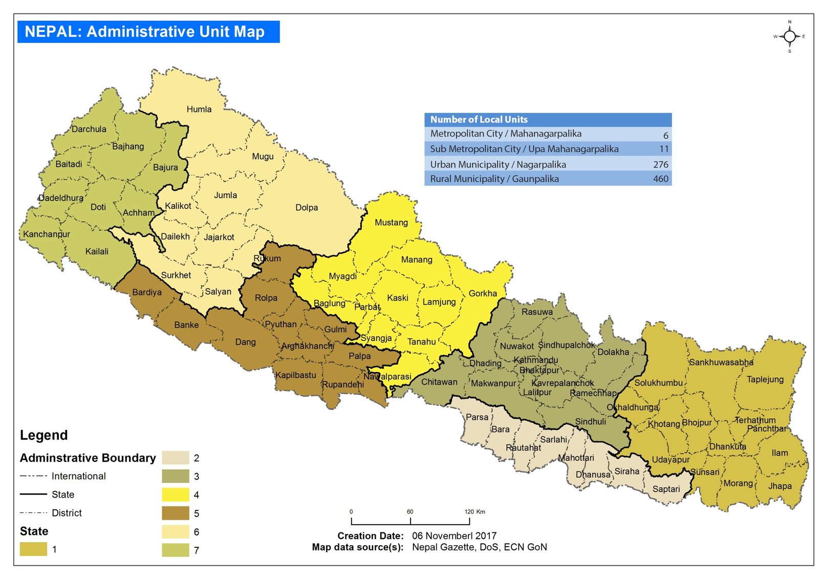
Title: NEPAL: Administrative Unit Map (as of 06 November 2017)
Publisher / Developer: Housing Recovery and Reconstruction Platform (HRRP) – Nepal
Creation / Publication Date: 06 November 2017
Map Data Source(s): Nepal Gazette, Department of Survey (DoS), and Election Commission of Nepal (ECN GoN)
Scale: Bar scale showing 0, 60, and 120 km
Classification: Humanitarian Coordination & Administrative Reference Map (Public Record / ReliefWeb Publication)
Published on November 6, 2017, by the Housing Recovery and Reconstruction Platform (HRRP) in Nepal, this map was disseminated via humanitarian portals like ReliefWeb to provide operational partners, earthquake recovery stakeholders, and administrative agencies with a clear visualization of Nepal's newly restructured federal framework following the 2015 Constitution.
Federal Provinces: Illustrates Nepal's 7 federal provinces (numbered State 1 through 7) rendered in distinct color codes.
Administrative Boundaries: Displays international boundaries, state lines, and the 75 district boundaries active during the 2017 transitional phase.
Local Units Summary Table: Features an overview box in the top-right corner detailing the counts for local government bodies:
Metropolitan City / Mahanagarpalika: 6
Sub Metropolitan City / Upa Mahanagarpalika: 11
Urban Municipality / Nagarpalika: 276
Rural Municipality / Gaunpalika: 460