
Welcome to our Map collection!
Map of Nepal (Political and Administrative)- Nepali
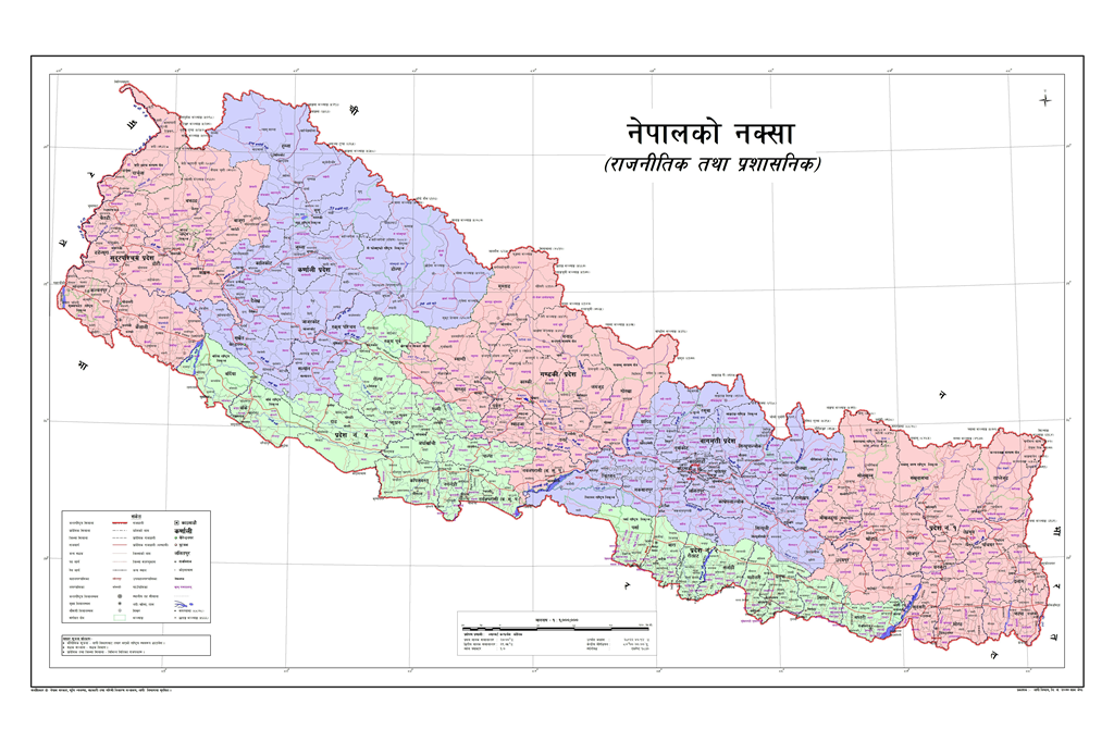
Title: नेपालको नक्सा (राजनीतिक तथा प्रशासनिक) — Map of Nepal (Political and Administrative)
Publisher / Developer: Survey Department, Government of Nepal
Publication Date: May 2020 (Jestha 2077 B.S.) — Official release of the updated administrative map (Chuche Naksha)
Scale: 1:1,000,000 (indicated by 1M scale coding and standard scale bar at the bottom center)
Language: Nepali (Devanagari script)
Classification: Official Government / National Political Map (Public Record / Official Reference)
This is the official revised administrative map released by the Government of Nepal in May 2020 (Jestha 2077 B.S.). It was published following the implementation of the 2015 Federal Constitution and the formal political update to the northwestern international boundary line in Darchula District, Sudurpashchim Province.
Administrative Divisions: Delineates Nepal’s 7 Federal Provinces in distinct pastel colors alongside the boundaries for all 77 districts and local level administrative units (Municipalities and Rural Municipalities / Gaunpalikas).
Cartographic Detail: Rendered in Devanagari script, the map outlines major rivers, provincial capitals, district headquarters, local administrative hubs, and the national transport grid.
Legend (संकेत): Positioned in the bottom-left corner, detailing official map symbols for international, provincial, district, and local government boundaries, highway classifications, and administrative centers.