
Welcome to our Map collection!
Nepal Physical / Natural with Nepal-Political as an inset map
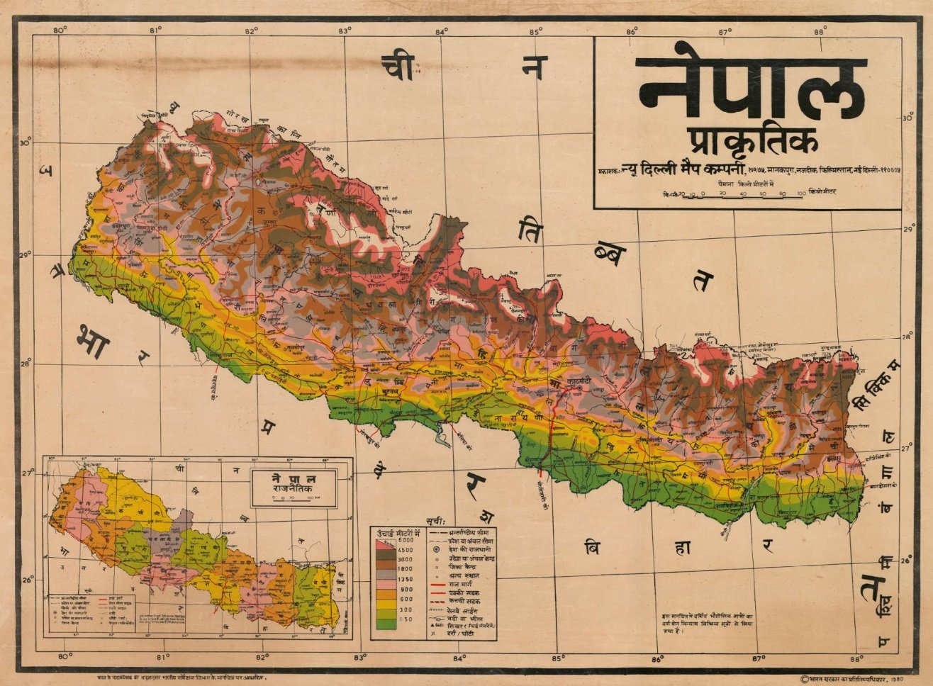
Title: Nepal Physical / Natural with Nepal-Political as an inset map
Publisher / Developer: New Delhi Map Company, 2174/16, Manakpura, near Filmistan, New Delhi-110005)
Publication Date: 1980
Scale: Bar scale showing distances in kilometers (0 to 100 km)
Language: Hindi (Devanagari script)
Classification: Wall Map / Educational Physical & Political Map (Public Domain / Historical Reference)
Context:
Published in New Delhi in 1980, this Hindi-language educational wall map was designed for school and general reference use across India and Nepal, illustrating Nepal's physical topography alongside its internal political divisions during the Panchayat era.
Description:
Main Map (Physical): Uses hypsometric color tinting—ranging from green (under 150m) up to dark brown/pink (6000m+)—to show physical elevation zones, major rivers, mountain ranges (Dhaulagiri, Annapurna, Everest/Sagarmatha), highways, and district/zone centers.
Inset Map (Political): Located in the bottom-left corner, it outlines Nepal’s administrative divisions (the 14 Zones / Anchal) in distinct pastel colors.
Legend: Details elevation layers in meters, international boundaries, zone/district headquarters, capital cities, highways, unpaved roads, railway lines, and mountain passes/peaks.