
Welcome to our Map collection!
Map showing Routes of Native Explorers in Tibet and Nepal – 1875
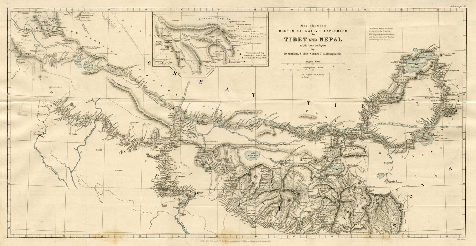
Title: Map showing Routes of Native Explorers in Tibet and Nepal to illustrate the Papers by Mr. Markham & Lieut. Colonel T.G. Montgomerie
Publisher / Developer: Published for the Royal Geographical Society by John Murray, London
Publication Date: 1875 (published in the Journal of the Royal Geographical Society, Vol. 45, 1875)
Engraver / Lithographer: Edward Weller (Lithographer, London)
Scale: Scale of English Miles (approx. 1 inch = 55 miles)
Classification: Historical Secret Exploration / Route Survey Map (Public Domain)
Context:
Compiled under the direction of Lt.-Col. T.G. Montgomerie of the Great Trigonometrical Survey of India, this map documents the covert reconnaissance missions carried out by secret Indian and Himalayan surveyors (known as the Pandits, including Hari Ram / "M-H" and Nain Singh Rawat). Because foreign Europeans were strictly barred from entering Nepal and Tibet, these native explorers were trained to covertly measure distances using standardized pacing beads (rosaries) and hidden compasses.
Description:
Drawn on a latitude-longitude grid across northern Nepal, southern Tibet, and the trans-Himalayan plateau, the map traces major clandestine routes connecting Nepal, Lhasa, Lake Tengri Nor (Namtso), and western Tibet. It features a top-center inset (Continuation of Map: North-West of Gartok) detailing routes toward Ladak and includes elevation spot heights, river courses (Yarlung Tsangpo, Karnali, Gandaki, Kosi networks), and mountain pass traverses recorded by the Pandit surveyors.