
Welcome to our Map collection!
Geodetic Triangulation Map of Mt.Everest – 1857
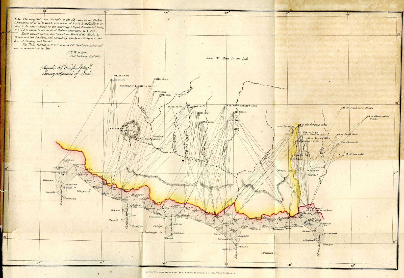
Title: Map showing the Triangulation for determining the positions and heights of the Peaks of the Himalaya Mountains in Nepal and Sikim (published in the Journal of the Asiatic Society of Bengal, Vol. 26, 1857)
Publisher / Developer: Major-General A.S. Waugh (Surveyor General of India) & W.H. Scott (Chief Draftsman, Field Office) / Survey of India
Publication Date: 1857 (survey rays executed 1845–1850; signed by Waugh in 1856 and printed at Calcutta in Nov 1857)
Scale: Scale 32 Miles to an Inch
Classification: Historical Geodetic Triangulation Map (Public Domain)
Context:
This historic map documents the primary trigonometric triangulation scheme executed by the Great Trigonometrical Survey of India that officially calculated the height of "Peak XV" (marked here as "Mt. Everest 29,002 ft") and confirmed it as the highest mountain in the world.
Description:
Drawn across a coordinate grid over northern India, Nepal, and Sikkim, the map displays the sightlines and rays shot from observation stations in the Gangetic plains (along the Bettiah and North-East Longitudinal series) to prominent Himalayan peaks. In addition to Mount Everest, sightlines are plotted to "Kanchinjinga" (Kangchenjunga) and "Katmandoo". Handwritten notes in the top-left detail geodetic corrections for longitudes (referenced to the Madras Observatory) and sea-level height adjustments.