
Welcome to our Map collection!
1857 Nepal Sikim Bhutan and Tibet by Hodgson
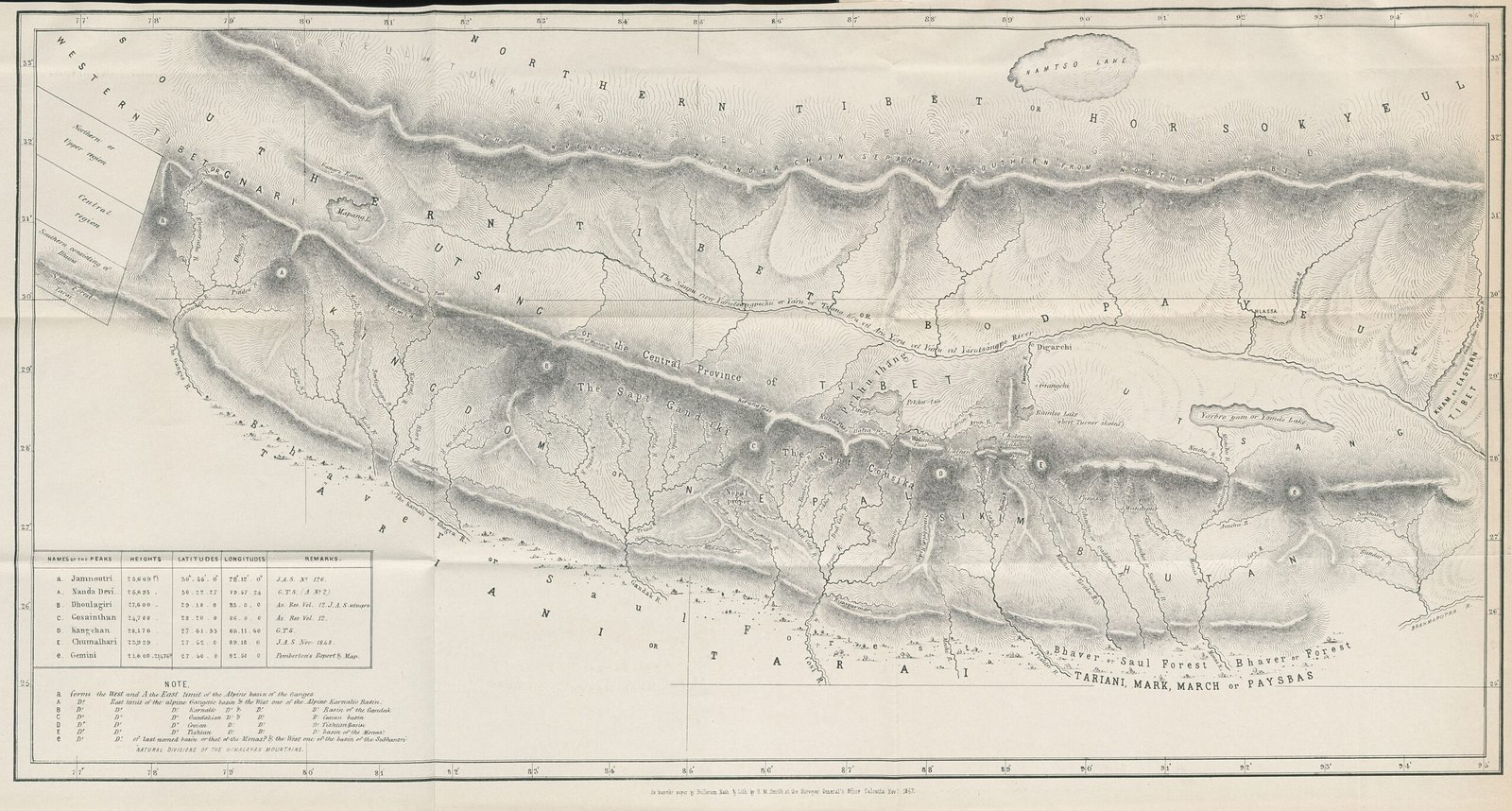
Title: Nepal Sikim Bhutan and Tibet (also cataloged as Comparative Chart of the Himalaya and Sub-Himalaya Systems)
Publisher / Cartographer: Brian Houghton Hodgson (published in the Journal of the Asiatic Society of Bengal)
Publication Date: 1857
Classification: Historical Comparative Topographical Chart (Public Domain)
Context:
Published in 1857 following Hodgson’s multi-decade residency in Kathmandu and Darjeeling, this thematic chart was created to illustrate his physical and hydrographic theories regarding the parallel structure of the Himalayan ranges across Nepal, Sikkim, Bhutan, and Tibet.
Description:
Designed as a panoramic hypsometric profile and hydrographic layout, the map highlights major Himalayan river basins (including the Indus, Ganges, and Brahmaputra networks) and mountain crests across the region. The inset tables in the lower-left corner list mountain peak elevations, latitudes, longitudes, and comparative geographic terminology.