
Welcome to our Map collection!
Physical / Administrative map of Nepal
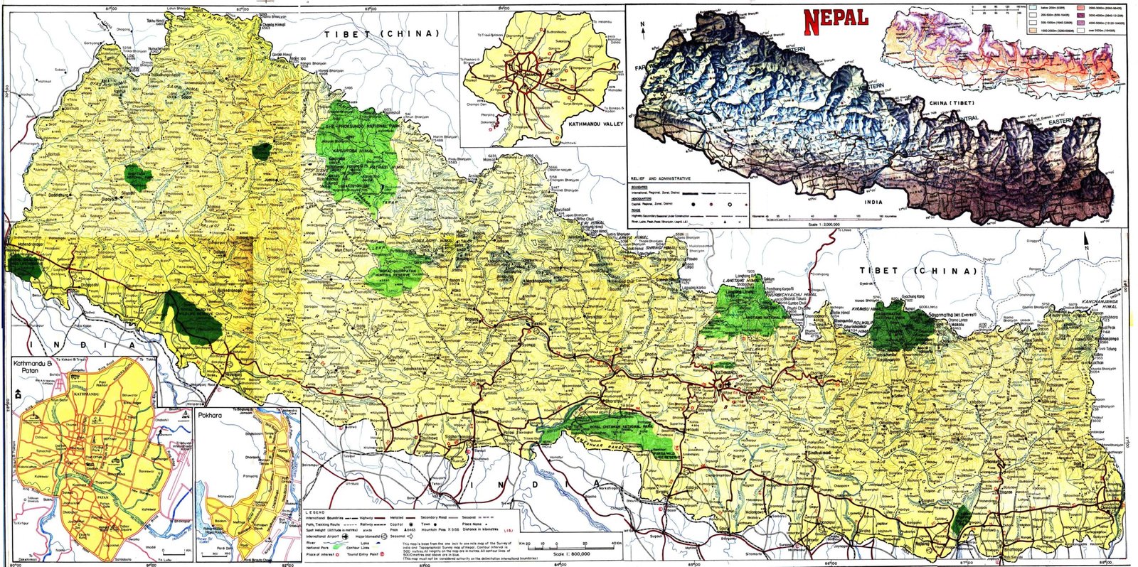
Title: Nepal (Tourist Map / Physical & Administrative Map)
Publisher / Developer: Survey Department, Government of Nepal (in collaboration with the Nepal Tourism Board / Department of Tourism).
Publication Date: Circa late 1990s – early 2000s
Scale: Main map 1:850,000 (with localized insets at larger scales)
Classification: Official Government / Public Reference Map
Context:
Produced by official Nepalese cartographic authorities, this comprehensive general reference sheet was designed as a dual-purpose administrative and tourist map to support national navigation, travel planning, and geographical education.
Description:
The primary map depicts Nepal's full national boundaries, major highway networks (such as the Mahendra, Prithvi, and Arniko highways), district/regional administrative centers, and national parks or protected wildlife reserves (highlighted in dark green).