
Welcome to our Map collection!
Kathmandu
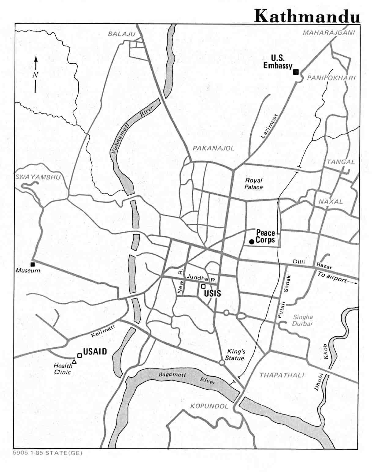
Title: Kathmandu
Publisher / Developer: United States Department of State (indicated by STATE(GE) in the bottom-left margin code)
Publication Date: January 1985 (indicated by 1-85)
Document / Map Control Number: 5905 1-85 STATE(GE)
Scale: Unstated / Schematic orientation map
Classification: Public Domain / Unclassified US Government Work
Context:
Produced in January 1985 by the Department of State, this simplified street orientation map was created for official U.S. personnel, diplomatic staff, and peace corps volunteers visiting or residing in Kathmandu during the mid-1980s.
Description:
The map provides a clear layout of central Kathmandu's primary road network, key rivers (Vishnumati, Bagamati, and Dhobi Khola), and major urban landmarks. It explicitly highlights U.S. diplomatic and aid infrastructure, including the former U.S. Embassy in Panipokhari (along Lazimpat), the Peace Corps office near Naxal, USIS (United States Information Service) near Juddha Sadak / New Road, USAID in Rabi Bhawan / Kalimati, and an adjacent Health Clinic, alongside local reference points like the Royal Palace, Swayambhu, Singha Durbar, and Thapathali.