
Welcome to our Map collection!
Selected Ethnic Groups of Nepal – 1985
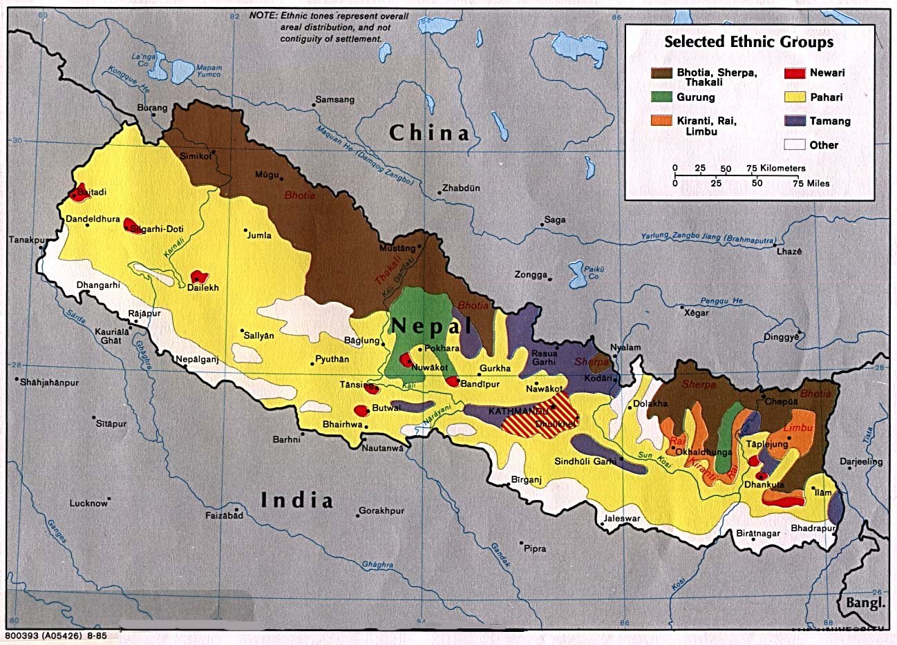
Title: Selected Ethnic Groups [Nepal]
Publisher / Developer: Central Intelligence Agency (CIA), Director of Intelligence (Cartography / Map Design Unit)
Publication Date: August 1985 (indicated by the standard CIA document code 8-85 in the bottom-left corner)
Document Control Number: 800393 (A05426) 8-85
Scale: 1:4,050,000
Classification: Public Domain / Unclassified US Government Work
Context:
This map was produced by the CIA for administrative, briefing, and thematic reference purposes during the Cold War era.
Description:
It illustrates the spatial distribution of major ethnic communities across Nepal (such as Bhotia/Sherpa/Thakali, Pahari, Gurung, Tamang, Kiranti/Rai/Limbu, Newari, and others) using color tones. As noted at the top of the map, the shaded areas represent general regional distribution rather than strict contiguity of individual settlements.