
Welcome to our Map collection!
Nepal Location Map – 2013
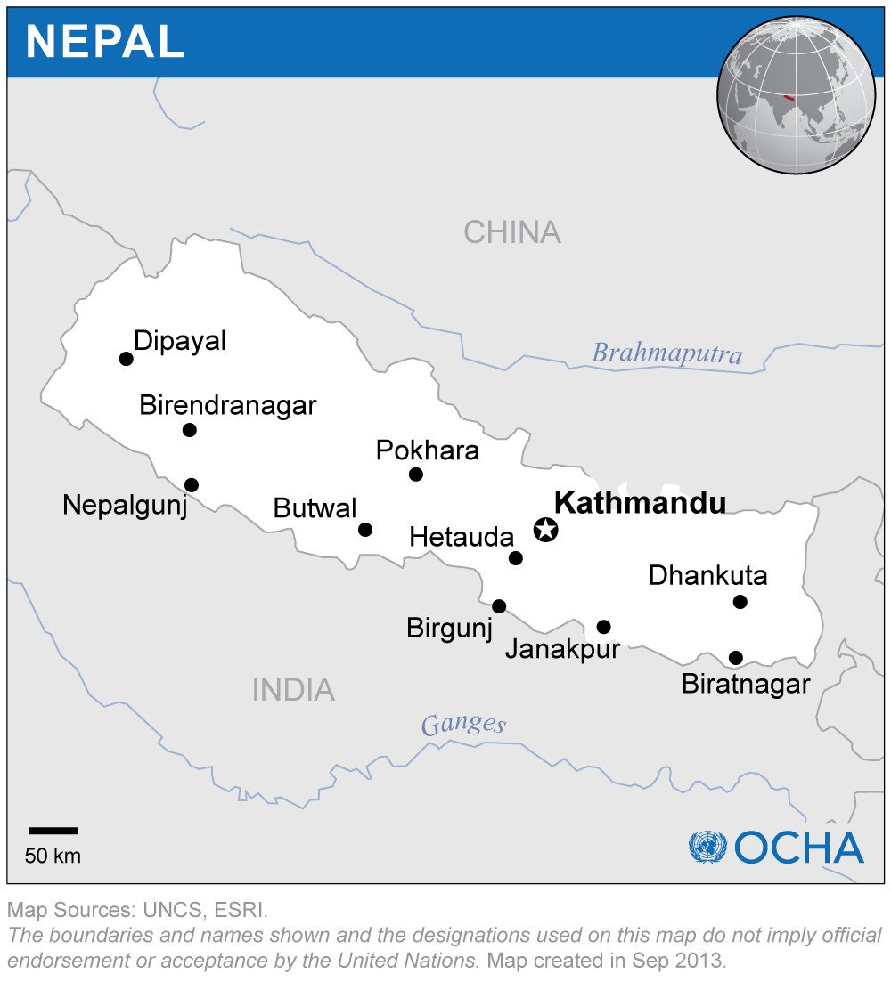
Title: Nepal (Location Map)
Publisher / Developer: UN Office for the Coordination of Humanitarian Affairs (OCHA) Field Information Services Section (FISS)
Publication Date: September 2013 (indicated in the bottom margin)
Map Sources: United Nations Cartographic Section (UNCS), ESRI
Scale: Scale bar showing 50 km (approx. 1:5,000,000)
Classification: Public Domain / UN Humanitarian Information Product
Context:
Created as part of UN OCHA's standardized global location map series, this simplified outline map is designed for rapid humanitarian reporting, disaster response coordination, and general briefing materials.
Description:
The map displays a clean vector outline of Nepal, highlighting the capital (Kathmandu) alongside key regional hubs and former development region centers (Dipayal, Birendranagar, Nepalgunj, Pokhara, Butwal, Hetauda, Birgunj, Janakpur, Dhankuta, and Biratnagar). It includes a global orthographic locator globe in the top-right corner, major regional rivers (Ganges, Brahmaputra), and international borders with India and China.